A Total Solar Eclipse Over South America
A Total Solar Eclipse Over South America
On Dec. 14, 2020, a total solar eclipse will pass over Chile and Argentina.

Solar eclipses happen when the Moon lines up just right between the Sun and Earth, allowing it to cast its shadow on Earth’s surface. People within the outer part of the Moon’s shadow will see the Sun partially blocked by the Moon, and those in the inner part of the shadow will see a total solar eclipse.

The Moon’s orbit around Earth is slightly tilted, meaning this alignment doesn’t happen on every orbit. Total solar eclipses happen somewhere on Earth about once every 18 months.

During a total solar eclipse, the Moon blocks out the Sun’s bright face, revealing its comparatively faint outer atmosphere, the corona. This provides Sun-watchers and scientists alike with a rare chance to see the solar corona closer to the Sun’s surface than is usually possible.

Scientists can take advantage of this unparalleled view — and solar eclipses’ unique effects on Earth’s atmosphere — to perform unique scientific studies on the Sun and its effects on Earth. Several NASA-funded science teams performed such studies during the total solar eclipse in the United States on Aug. 21, 2017. Read about what they’ve learned so far.
Watching the eclipse
We’ll be carrying images of December’s eclipse — courtesy of Pontificia Universidad Católica de Chile — on NASA TV and on the agency’s website starting at 9:40 a.m. EST on Dec. 14.
We’ll also have a live show in Spanish from 10:30 – 11:30 a.m. EST featuring views of the eclipse and NASA scientists.
If you’re observing the eclipse in person, remember that it’s never safe to look directly at the uneclipsed or partially eclipsed Sun. You can use special solar viewing glasses (NOT sunglasses) or an indirect method like pinhole projection to watch the eclipse in person.

For people in the path of totality, there will be a few brief moments when it is safe to look directly at the eclipse. Only once the Moon has completely covered the Sun and there is no sunlight shining is it safe to look at the eclipse. Make sure you put your eclipse glasses back on or return to indirect viewing before the first flash of sunlight appears around the Moon’s edge.
Mira el eclipse en vivo comentado por científicas de la NASA de 10:30 a 11:30 a.m. EST el 14 de diciembre en NASA TV y la página web de la agencia. Lee más sobre el eclipse y cómo observarlo de forma segura aquí: https://ciencia.nasa.gov/eclipse-de-2020-en-america-del-sur Y sigue a NASA en español en Instagram, Twitter, YouTube y Facebook.
Make sure to follow us on Tumblr for your regular dose of space: http://nasa.tumblr.com.
More Posts from Nasa and Others
NASA Spotlight: Carbon Cycle and Ecosystems Earth Scientist Erika Podest
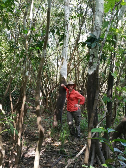
Dr. Erika Podest is a scientist with the Carbon Cycle and Ecosystems Group in our Jet Propulsion Laboratory’s Earth Science Division and Visiting Associate Researcher in the Joint Institute for Regional Earth System Science and Engineering (JIFRESSE) at UCLA. Her research entails using satellite images to study Earth’s ecosystems specifically related to wetlands and boreal forests and how they are being affected by climate change.
Erika took time from studying our home planet to answer questions about her life and career! Get to know our Earth Scientist:
What inspires/motivates you?
I am inspired by the beauty of nature, its perfection and by the peace it brings me. My motivation is to make a positive impact on our planet by better understanding it and caring for it.
What first sparked your interest in Earth science?
I was born and raised in Panama, which is a country with an exuberant nature. Since I can remember, I was always surrounded by nature because my father was an adventurer who loved the outdoors and always took me with him to go exploring or simply to enjoy a nice relaxing day outside. This led me to develop a deep sense of appreciation, respect, and curiosity for nature, which sparked my interest to learn about it and pursue a career in Earth Science.
What got you interested in the study of Earth from space?

Early in my college years I was training for my private pilot’s license and during my solo flights I would take pictures of features on the surface from the plane. I was always amazed at the details the pictures showed of the landscape that were not obvious from the ground. This was the first step towards discovering that there was a field for studying Earth from above, called remote sensing and consequently my Masters and Ph.D. were focused in this field.
What technology, discovery, or policy do you think has the most potential to decrease humans’ environmental impact (e.g. wind turbines, carbon taxes, clean meat)?
I don’t think it is a matter of any one technology, discovery or policy. It is a combination of everything. Having an impact on climate change involves every level and direction, from the bottom up at the individual, grassroots and community level to the top down at the policy level. As individuals, I think it is important to educate ourselves about climate change (I suggest climate.nasa.gov). We all have the power to make a positive change by speaking up and making informed decisions about our consumptive habits.
What’s a fact about the role of wetlands and boreal forests in the global ecosystem that you think would surprise people?

Wetlands provide a vital role in carbon storage. Even though they cover about 5-8% of the Earth’s land surface, studies indicate that they contain a disproportionate amount of our planet’s total soil carbon, about 20-30%. In addition, they are like the arteries and veins of the landscape, acting as water sources and purifiers and helping in flood control. They also protect our shores and harbor large amounts of biodiversity.
Boreal forests are found in the uppermost northern hemisphere (Alaska, most of Canada, Russia, Scandinavia and northern Asia) and account for about 30% of the world’s forest cover. These forests lock up enormous amounts of carbon and help slow the increasing buildup of carbon dioxide in our atmosphere. In their peak growth phase during the northern spring and summer, the worldwide levels of carbon dioxide fall and the worldwide levels of oxygen rise.
Can you describe a typical day on a research trip?

It depends on the research trip. For example, one of my more recent ones was to the Peruvian Amazon where we went upriver on a boat for three weeks on a major tributary of the Amazon River called the Ucuyali River. I was with a team of eight researchers and we were studying the wetland ecosystems of the Pacaya-Samiria Natural Reserve, which entailed making vegetation measurements and assessing inundation extent to validate our scientific findings from satellite observations. We camped for most of the trip and a typical day entailed waking up at around 5:00 am with a symphony of sounds that emerged from the forest, including monkeys. We had breakfast and set off from base camp into the forest (~1 hour walk) to work an 8-9 hour day with a short lunch break (we had packed lunches) at noon. At the end of the day I’d be drenched in sweat, sunscreen, insect repellent, and dust and I’d bathe with water from the river, which was as brown as a milk chocolate bar. It was the most refreshing and cleansing feeling! The day would close with dinner followed with a discussion of the measurements to be collected the following day. Lights were out by 7:30 pm (which seemed like midnight) and I’d re-emerge myself into my tent in the dark tropical night surrounded by the sounds of the forest, until the next morning.
What are some of the most important lessons you’ve learned in life?
That it is important to be patient, humble and thankful.
Do you have any secret skills, talents, or hobbies?
Great question! I do not have any secrete skills or talents but I do have a couple of hobbies. I play the piano, though I am still a novice. I love windsurfing. It is an amazing feeling to skim over the water at fast speeds (I’m also an adrenaline junkie). Finally, I am fascinated by magic card tricks and whenever I have some free time I like to learn a new trick.
What do you enjoy the most about your job?
I enjoy constantly learning about our natural world and how it works. I also really enjoy communicating my work to students and to the general public. I find it especially rewarding when I can educate people and motivate students to consider careers in science.
Erika, thank you for your time and everything you do to keep our home planet safe!
Make sure to follow us on Tumblr for your regular dose of space: http://nasa.tumblr.com.
Follow NASA’s Artemis I Moon Mission: Live Tracker, Latest Images, and Videos
On Nov. 16, 2022, the Artemis I mission officially began with the launch of the Orion spacecraft atop the Space Launch System rocket. The rocket and spacecraft lifted off from historic Launch Complex 39B at NASA’s Kennedy Space Center in Florida.
Now, the Orion spacecraft is about halfway through its journey around the Moon. Although the spacecraft is uncrewed, the Artemis I mission prepares us for future missions with astronauts, starting with Artemis II.
Stay up-to-date with the mission with the latest full-resolution images, mission updates, on-demand and live video.

Imagery:
Find full-resolution images from the Orion spacecraft as they are released here.
Launch imagery can be found here. When Orion splashes down in the Pacific Ocean on Dec. 11, the images will be available here, as well!
Videos:
This playlist contains informational videos, as well as upcoming and past live events, about Artemis I.
You can watch a livestream of the Artemis I mission here. (Just a note: the livestream may cut off during moments when the Orion team needs higher bandwidth for activities.)
Keep yourself updated on the upcoming broadcasts of Artemis milestones with the NASA TV schedule.

Trackers:
Our Artemis I Tracker uses live telemetry data streamed directly from Mission Control Center in Houston to show Orion position, attitude, solar array positions, and thruster firings throughout the mission.
“Eyes on the Solar System” shows Orion's position along the Artemis I trajectory and in relation to other NASA spacecraft and objects in the solar system.
“DSN Now” shows which antenna on Earth’s Deep Space Network is communicating with Orion.
Updates:
Read up on where Orion is and what’s next in the Artemis I mission with the Mission Blog.
Thank you so much for following with us on this historic mission. Go Artemis!
Make sure to follow us on Tumblr for your regular dose of space!
International Space Station
The International Space Station is an important and special place that is built on international cooperation and partnership. The station is a convergence of science, technology and human innovation that benefits and advances our global community here on Earth.

While the space station is an important aspect of our low-Earth orbit exploration, it is also the key to our next giant leap to deep space and our Journey to Mars. For example, our recent VEGGIE experiment aboard the space station is a critical aspect of long-duration exploration missions farther into the solar system. Food grown in space will be a resource for crew members that can provide them will essential vitamins and nutrients that will help enable deep space pioneering.
Another important experiment underway is the Twins Study that involves twin astronauts Scott and Mark Kelly. These investigations will provide insight into the subtle effects and changes that may occur in spaceflight as compared to Earth by studying two individuals who have the same genetics, but are in different environments for one year. You can follow Scott Kelly as he spends a year in space.
The space station is the second brightest object in the sky (after the moon, of course), and you don’t even need a telescope to see it! We can even tell you exactly when and where to look up to Spot the Station in your area!
So, as you look to spot the station in the sky, remember that even though it may look small from Earth, the crew onboard (and at home) are making contributions to international partnerships and global research.
Things You Might Not Know About Our Sun

The sun is a star, a hot ball of glowing gases at the heart of our solar system. Its influence extends far beyond the orbits of distant Neptune and Pluto. Without the sun’s intense energy and heat, there would be no life on Earth. And though it is special to us, there are billions of stars like our sun scattered across the Milky Way galaxy.

Impress Your Friends with These Sun Facts:
If the sun were as tall as a typical front door, the Earth would be the size of a U.S. nickel
The temperature at the sun’s core is about 27 million degrees Fahrenheit
Our sun is more massive than the average star in its neighborhood. Nearly 90% of stars are less massive, making them cooler and dimmer
The sun contains 99.9% of all matter in our solar system
During a single second, the sun converts 4 million tons of matter to pure energy
It would take about 1 million Earths to fill the sun if it were a hollow ball
The sun rotates on its axis approximately once every 27 days
The sun is 93 million miles away from Earth and is almost 5 billion years old
Make sure to follow us on Tumblr for your regular dose of space: http://nasa.tumblr.com
Human Research, Robotic Refueling, Crystallography and More Headed to Orbiting Lab
New science is headed to the International Space Station aboard the SpaceX Dragon.
Investigations on this flight include a test of robotic technology for refueling spacecraft, a project to map the world’s forests and two student studies inspired by Marvel’s “Guardians of the Galaxy” series.
Learn more about the science heading into low-Earth orbit:
The forest is strong with this one: GEDI studies Earth’s forests in 3D
The Global Ecosystem Dynamics Investigation (GEDI) is an instrument to measure and map Earth’s tropical and temperate forests in 3D.

The Jedi knights may help protect a galaxy far, far away, but our GEDI will help us study and understand forest changes right here on Earth.
Robotic refueling in space
What’s cooler than cool? Cryogenic propellants, or ice-cold spacecraft fuel! Our Robotic Refueling Mission 3 (RRM3) will demonstrate technologies for storing and transferring these special liquids. By establishing ways to replenish this fuel supply in space, RRM3 could help spacecraft live longer and journey farther.

The mission’s techniques could even be applied to potential lunar gas stations at the Moon, or refueling rockets departing from Mars.
Staying strong in space
The Molecular Muscle investigation examines the molecular causes of muscle abnormalities from spaceflight in C. elgans, a roundworm and model organism.
This study could give researchers a better understanding of why muscles deteriorate in microgravity so they can improve methods to help crew members maintain their strength in space.

Investigation studies space-grown crystals for protection against radiation
Perfect Crystals is a study to learn more about an antioxidant protein called manganese superoxide dismutase that protects the body from the effects of radiation and some harmful chemicals.
The station’s microgravity environment allows researchers to grow more perfectly ordered crystals of the proteins. These crystals are brought back to Earth and studied in detail to learn more about how the manganese superoxide dismutase works. Understanding how this protein functions may aid researchers in developing techniques to reduce the threat of radiation exposure to astronauts as well as prevent and treat some kinds of cancers on Earth.
Satellite deployment reaching new heights with SlingShot
SlingShot is a new, cost-effective commercial satellite deployment system that will be tested for the first time.

SlingShot hardware, two small CubeSats, and a hosted payload will be carried to the station inside SpaceX’s Dragon capsule and installed on a Cygnus spacecraft already docked to the orbiting laboratory. Later, Cygnus will depart station and fly to a pre-determined altitude to release the satellites and interact with the hosted payload.
Investigation studies accelerated aging in microgravity
Spaceflight appears to accelerate aging in both humans and mice. Rodent Research-8 (RR-8) is a study to understand the physiology of aging and the role it plays on the progression of disease in humans. This investigation could provide a better understanding of how aging changes the body, which may lead to new therapies for related conditions experienced by astronauts in space and people on Earth.
Guardians of the space station: Student contest flies to orbiting lab
The MARVEL ‘Guardians of the Galaxy’ Space Station Challenge is a joint project between the U.S. National Laboratory and Marvel Entertainment featuring two winning experiments from a contest for American teenage students. For the contest, students were asked to submit microgravity experiment concepts that related to the Rocket and Groot characters from Marvel’s “Guardians of the Galaxy” comic book series.

Team Rocket: Staying Healthy in Space
If an astronaut suffers a broken tooth or lost filling in space, they need a reliable and easy way to fix it. This experiment investigates how well a dental glue activated by ultraviolet light would work in microgravity. Researchers will evaluate the use of the glue by treating simulated broken teeth and testing them aboard the station.
Team Groot: Aeroponic Farming in Microgravity
This experiment explores an alternative method for watering plants in the absence of gravity using a misting device to deliver water to the plant roots and an air pump to blow excess water away. Results from this experiment may enable humans to grow fruits and vegetables in microgravity, and eliminate a major obstacle for long-term spaceflight.
These investigation join hundreds of others currently happening aboard the station. For more info, follow @ISS_Research!
Make sure to follow us on Tumblr for your regular dose of space: http://nasa.tumblr.com
Solar System: Things to Know This Week
Reaching out into space yields benefits on Earth. Many of these have practical applications — but there's something more than that. Call it inspiration, perhaps, what photographer Ansel Adams referred to as nature's "endless prospect of magic and wonder."
Our ongoing exploration of the solar system has yielded more than a few magical images. Why not keep some of them close by to inspire your own explorations? This week, we offer 10 planetary photos suitable for wallpapers on your desktop or phone. Find many more in our galleries. These images were the result of audacious expeditions into deep space; as author Edward Abbey said, "May your trails be crooked, winding, lonesome, dangerous, leading to the most amazing view."

1. Martian Selfie
This self-portrait of NASA's Curiosity Mars rover shows the robotic geologist in the "Murray Buttes" area on lower Mount Sharp. Key features on the skyline of this panorama are the dark mesa called "M12" to the left of the rover's mast and pale, upper Mount Sharp to the right of the mast. The top of M12 stands about 23 feet (7 meters) above the base of the sloping piles of rocks just behind Curiosity. The scene combines approximately 60 images taken by the Mars Hand Lens Imager, or MAHLI, camera at the end of the rover's robotic arm. Most of the component images were taken on September 17, 2016.
800 x 600
1024 x 768
1280 x 1024
1600 x 1200
1280 x 800
1440 x 900
1920 x 1200

2. The Colors of Pluto
NASA's New Horizons spacecraft captured this high-resolution, enhanced color view of Pluto on July 14, 2015. The image combines blue, red and infrared images taken by the Ralph/Multispectral Visual Imaging Camera (MVIC). Pluto's surface sports a remarkable range of subtle colors, enhanced in this view to a rainbow of pale blues, yellows, oranges, and deep reds. Many landforms have their own distinct colors, telling a complex geological and climatological story that scientists have only just begun to decode.
800 x 600
1024 x 768
1280 x 1024
1600 x 1200
1280 x 800
1440 x 900
1920 x 1200

3. The Day the Earth Smiled
On July 19, 2013, in an event celebrated the world over, our Cassini spacecraft slipped into Saturn's shadow and turned to image the planet, seven of its moons, its inner rings — and, in the background, our home planet, Earth. This mosaic is special as it marks the third time our home planet was imaged from the outer solar system; the second time it was imaged by Cassini from Saturn's orbit, the first time ever that inhabitants of Earth were made aware in advance that their photo would be taken from such a great distance.
800 x 600
1024 x 768
1280 x 1024
1600 x 1200
1280 x 800
1440 x 900
1920 x 1200

4. Looking Back
Before leaving the Pluto system forever, New Horizons turned back to see Pluto backlit by the sun. The small world's haze layer shows its blue color in this picture. The high-altitude haze is thought to be similar in nature to that seen at Saturn's moon Titan. The source of both hazes likely involves sunlight-initiated chemical reactions of nitrogen and methane, leading to relatively small, soot-like particles called tholins. This image was generated by combining information from blue, red and near-infrared images to closely replicate the color a human eye would perceive.
800 x 600
1024 x 768
1280 x 1024
1600 x 1200
1280 x 800
1440 x 900
1920 x 1200

5. Catching Its Own Tail
A huge storm churning through the atmosphere in Saturn's northern hemisphere overtakes itself as it encircles the planet in this true-color view from Cassini. This picture, captured on February 25, 2011, was taken about 12 weeks after the storm began, and the clouds by this time had formed a tail that wrapped around the planet. The storm is a prodigious source of radio noise, which comes from lightning deep within the planet's atmosphere.
800 x 600
1024 x 768
1280 x 1024
1600 x 1200
1280 x 800
1440 x 900
1920 x 1200

6. The Great Red Spot
Another massive storm, this time on Jupiter, as seen in this dramatic close-up by Voyager 1 in 1979. The Great Red Spot is much larger than the entire Earth.
800 x 600
1024 x 768
1280 x 1024
1600 x 1200
1280 x 800
1440 x 900
1920 x 1200

7. More Stormy Weather
Jupiter is still just as stormy today, as seen in this recent view from NASA's Juno spacecraft, when it soared directly over Jupiter's south pole on February 2, 2017, from an altitude of about 62,800 miles (101,000 kilometers) above the cloud tops. From this unique vantage point we see the terminator (where day meets night) cutting across the Jovian south polar region's restless, marbled atmosphere with the south pole itself approximately in the center of that border. This image was processed by citizen scientist John Landino. This enhanced color version highlights the bright high clouds and numerous meandering oval storms.
800 x 600
1024 x 768
1280 x 1024
1600 x 1200
1280 x 800
1440 x 900
1920 x 1200

8. X-Ray Vision
X-rays stream off the sun in this image showing observations from by our Nuclear Spectroscopic Telescope Array, or NuSTAR, overlaid on a picture taken by our Solar Dynamics Observatory (SDO). The NuSTAR data, seen in green and blue, reveal solar high-energy emission. The high-energy X-rays come from gas heated to above 3 million degrees. The red channel represents ultraviolet light captured by SDO, and shows the presence of lower-temperature material in the solar atmosphere at 1 million degrees.
800 x 600
1024 x 768
1280 x 1024
1600 x 1200
1280 x 800
1440 x 900
1920 x 1200

9. One Space Robot Photographs Another
This image from NASA's Mars Reconnaissance Orbiter shows Victoria crater, near the equator of Mars. The crater is approximately half a mile (800 meters) in diameter. It has a distinctive scalloped shape to its rim, caused by erosion and downhill movement of crater wall material. Since January 2004, the Mars Exploration Rover Opportunity has been operating in the region where Victoria crater is found. Five days before this image was taken in October 2006, Opportunity arrived at the rim of the crater after a drive of more than over 5 miles (9 kilometers). The rover can be seen in this image, as a dot at roughly the "ten o'clock" position along the rim of the crater. (You can zoom in on the full-resolution version here.)
800 x 600
1024 x 768
1280 x 1024
1600 x 1200
1280 x 800
1440 x 900
1920 x 1200

10. Night Lights
Last, but far from least, is this remarkable new view of our home planet. Last week, we released new global maps of Earth at night, providing the clearest yet composite view of the patterns of human settlement across our planet. This composite image, one of three new full-hemisphere views, provides a view of the Americas at night from the NASA-NOAA Suomi-NPP satellite. The clouds and sun glint — added here for aesthetic effect — are derived from MODIS instrument land surface and cloud cover products.
Full Earth at night map
Americas at night
Discover more lists of 10 things to know about our solar system HERE.
Make sure to follow us on Tumblr for your regular dose of space: http://nasa.tumblr.com
6 Tiny Satellites That Are Changing How We See Earth

HARP: Hyper-Angular Rainbow Polarimeter
What’s better than taking a picture of a cloud to figure out its size and shape? Taking a bunch of pictures all around it. That way you get a three-dimensional view without having to worry about missing something. The HARP CubeSat is going to do just that: make observations of cloud droplets and tiny airborne particles like soot and dust with a modified camera lens from multiple angles. This will give us a full rendering of what’s going on inside the clouds, specifically, how those airborne particles act as “seeds” for water vapor to condense on and form cloud droplets. Since so many of those particles are in the air as a result of man-made pollution, we want to understand how they may be affecting clouds, weather and climate.

RAVAN: Radiometer Assessment using Vertically Aligned Nanotubes
Anyone who’s worn a black shirt on a summer day knows how much sunlight and heat it absorbs. The RAVAN 3-unit CubeSat, however, carries “blacker than black” technology – carbon nanotubes set up like a bundle of drinking straws that suck up nearly all the sunlight and energy that reach them to the point that your black shirt seems merely dark grey in comparison. Flying in low Earth orbit, RAVAN’s super sensitive instrument will detect tiny changes in the amount of sunlight and energy passing into and out of the top of the atmosphere. The amount of energy passing through the top of the atmosphere is where the net accounting of Earth’s energy budget happens – one of the major measurements we need in order to understand the effects of greenhouse gases on global warming and climate change.

MiRaTA: Microwave Radiometer Technology Acceleration
That long skinny piece coming out of the bottom right side under the solar panel? That’s a measuring tape. It’s doubling as a communications antenna on the MiRaTA CubeSat that will be a mini-weather station in space. This 3-unit, shoe box-sized satellite is testing out new, miniaturized technology to measure temperature, water vapor, and cloud ice in the atmosphere. They’ll be tracking major storms, including hurricanes, as well as everyday weather. If this test flight is successful, the new, smaller technology will likely be incorporated into major – large – weather satellite missions in the future that are part of our national infrastructure.

IceCube
The aptly named IceCube will measure – you guessed it – ice in our atmosphere. Unlike the droplets that make up rain, ice is one of the harder things to measure from space. IceCube is a 3-unit CubeSat about the size of a loaf of bread outfitted with a new high-frequency microwave radiometer, an instrument that measures naturally occurring radiation emitted by stuff in the atmosphere – cloud droplets, rain, and the ice particles at the tops of clouds. This will be the first space test of the new microwave radiometer that has to balance its tiny size and low power with being sensitive enough to detect cloud ice.

CYGNSS: Cyclone, Global Navigation Satellite System
What do GPS signals do when they’re not talking to your phone? A lot of them are just bouncing harmlessly off the planet’s surface – a fact that the CYGNSS mission is taking advantage of to measure wind speed over the ocean. Eight identical small satellites, each about the size of a microwave oven, flying in formation carry custom modified GPS receivers pointed at the oceans. When the water is smooth – not windy – the GPS signals reflect back uniformly, like the moon on a pond reflected as if in a mirror. When the water is choppy – windy – the signals reflect back in in the same direction but distorted, like the moon reflection on a choppy pond being distorted by ripples. Flying eight satellites in formation means the CYGNSS mission can measure wind speed across more of the ocean at once, which will help with understanding tropical storms and hurricanes.

TROPICS: Time-Resolved Observations of Precipitation structure and storm Intensity with a Constellation of Smallsats
An important way to improve forecasts of hurricane and tropical cyclone intensity is to see what’s going on inside and around them while they’re happening. That’s the goal of the TROPICS mission, 12 CubeSats that will fly in formation to track the temperature and humidity of storm environments. The TROPICS CubeSats will get very frequent measurements, similar to X-rays, that cut through the overall cloud-cover so we can see the storm’s underlying structure. The storm structures known as the eyewall – tall clouds, wind and rain around the eye – and rainbands – the rainy parts of the spiral arms – give us clues about whether a storm is primed to intensify into a category 4 or 5 storm, something everyone in their path needs to know.
Learn more the world of small satellites at: https://www.nasa.gov/mission_pages/smallsats
Make sure to follow us on Tumblr for your regular dose of space: http://nasa.tumblr.com
'Space Butterfly' Is Home to Hundreds of Baby Stars

What looks like a red butterfly in space is in reality a nursery for hundreds of baby stars, revealed in this infrared image from our Spitzer Space Telescope. Officially named Westerhout 40 (W40), the butterfly is a nebula — a giant cloud of gas and dust in space where new stars may form. The butterfly's two "wings" are giant bubbles of hot, interstellar gas blowing from the hottest, most massive stars in this region.
Besides being beautiful, W40 exemplifies how the formation of stars results in the destruction of the very clouds that helped create them. Inside giant clouds of gas and dust in space, the force of gravity pulls material together into dense clumps. Sometimes these clumps reach a critical density that allows stars to form at their cores. Radiation and winds coming from the most massive stars in those clouds — combined with the material spewed into space when those stars eventually explode — sometimes form bubbles like those in W40. But these processes also disperse the gas and dust, breaking up dense clumps and reducing or halting new star formation.
Make sure to follow us on Tumblr for your regular dose of space: http://nasa.tumblr.com
What in the Universe is an Exoplanet?
Simply put, an exoplanet is a planet that orbits another star.
All of the planets in our solar system orbit around the Sun. Planets that orbit around other stars outside our solar system are called exoplanets.

Just because a planet orbits a star (like Earth) does not mean that it is automatically stable for life. The planet must be within the habitable zone, which is the area around a star in which water has the potential to be liquid…aka not so close that all the water would evaporate, and not too far away where all the water would freeze.

Exoplanets are very hard to see directly with telescopes. They are hidden by the bright glare of the stars they orbit. So, astronomers use other ways to detect and study these distant planets by looking at the effects these planets have on the stars they orbit.

One way to search for exoplanets is to look for "wobbly" stars. A star that has planets doesn’t orbit perfectly around its center. From far away, this off-center orbit makes the star look like it’s wobbling. Hundreds of planets have been discovered using this method. However, only big planets—like Jupiter, or even larger—can be seen this way. Smaller Earth-like planets are much harder to find because they create only small wobbles that are hard to detect.
How can we find Earth-like planets in other solar systems?
In 2009, we launched a spacecraft called Kepler to look for exoplanets. Kepler looked for planets in a wide range of sizes and orbits. And these planets orbited around stars that varied in size and temperature.

Kepler detected exoplanets using something called the transit method. When a planet passes in front of its star, it’s called a transit. As the planet transits in front of the star, it blocks out a little bit of the star's light. That means a star will look a little less bright when the planet passes in front of it. Astronomers can observe how the brightness of the star changes during a transit. This can help them figure out the size of the planet.

By studying the time between transits, astronomers can also find out how far away the planet is from its star. This tells us something about the planet’s temperature. If a planet is just the right temperature, it could contain liquid water—an important ingredient for life.
So far, thousands of planets have been discovered by the Kepler mission.
We now know that exoplanets are very common in the universe. And future missions have been planned to discover many more!
Next month, we’re launching an explorer-class planet finder — the Transiting Exoplanet Survey Satellite (TESS). This mission will search the entire sky for exoplanets — planets outside our solar system that orbit sun-like stars.
Make sure to follow us on Tumblr for your regular dose of space: http://nasa.tumblr.com.
Solar System: 5 Things to Know This Week
The solar system is huge, so let us break it down for you. Here are 5 things you should know this week:
1. Mini-Moons

This week, the robotic spacecraft Cassini will pass a pair of tiny Saturnian moons. Daphnis, only 5.7 miles (9.2 km) across, orbits within the Keeler Gap in Saturn's outer A ring. Daphnis' slight gravity maintains that gap. Cassini will then swing by Telesto, a small moon that shares its orbit with Tethys. Cassini's cameras should get some good pictures of these tiny worlds.
2. Stardust Memories

Jan. 15 is the 10th anniversary of the day the Stardust capsule returned to Earth, carrying pieces of a comet. The Stardust spacecraft passed right through the gas and dust surrounding the icy nucleus of Wild 2 (pronounced "Vilt-2") in January 2004, then sent the samples it collected home for laboratory analysis.
3. Sun Surfing in the 70s

Jan. 15 is the 40th anniversary of the launch of Helios 2, the second of a pair of spacecraft launched by NASA and built by Germany to investigate the sun. Helios 2 flew to within about 27 million miles (44 million km) of the sun's surface in 1976. The spacecraft provided important information on solar plasma, the solar wind, cosmic rays, and cosmic dust, and also performed magnetic field and electrical field experiments. A NASA mission set to launch in 2018 will dare an even closer approach.
4. To Space, to Watch the Seas

Jason 3, an international mission to continue U.S.- European satellite measurements of the topography of the ocean surface, is scheduled to launch on Jan. 17. The mission will make highly detailed measurements of sea-level on Earth to gain insight into ocean circulation and climate change.
5. Getting Serious About Ceres

This is getting good. Over the past few weeks, the Dawn mission has been tantalizing us with ever-closer images of the dwarf planet Ceres, the largest object in the main asteroid belt and a small world in its own right. Now, the robotic spacecraft has used its ion engines to ease down into its lowest mapping orbit in order to scrutinize Ceres up close, and already the pictures are spectacular. Odd mountains, deep craters and fissures—not to mention those famous bright spots—will all be coming into sharper focus during the coming days.
Make sure to follow us on Tumblr for your regular dose of space: http://nasa.tumblr.com
-
 buhaybabae liked this · 8 months ago
 -
 gabrobeencningben liked this · 1 year ago
 -
 oralk liked this · 2 years ago
 -
 naturelover-cricri liked this · 3 years ago
 -
 voy-a-cambiar-de-estacion liked this · 3 years ago
 -
 epu liked this · 3 years ago
 -
 queerlien liked this · 3 years ago
 -
 powerfrog reblogged this · 4 years ago
 -
 guesstheending liked this · 4 years ago
 -
 kiziyorumoyleysevarim liked this · 4 years ago
 -
 inacidkubos liked this · 4 years ago
 -
 canigohomenow02 liked this · 4 years ago
 -
 mawusifitnesstraining liked this · 4 years ago
 -
 juicys-world-blog1 liked this · 4 years ago
 -
 usafphantom2 reblogged this · 4 years ago
 -
usafphantom2 liked this · 4 years ago
-
 sessizsair liked this · 4 years ago
 -
 izzyadelou-writes liked this · 4 years ago
 -
 hellodemoiselle liked this · 4 years ago
 -
 willtofier liked this · 4 years ago
 -
 saphicstarlight liked this · 4 years ago
 -
 phir-milenge liked this · 4 years ago
 -
 butyoutoldmeiwasfunny reblogged this · 4 years ago
 -
 ct2311 liked this · 4 years ago
 -
 1e4tfss liked this · 4 years ago
 -
 sassyabbs liked this · 4 years ago
 -
 daia-red-panda10 liked this · 4 years ago
 -
 vermilionvexation liked this · 4 years ago
 -
 ritathememermaid liked this · 4 years ago
 -
 adictaalaficcion liked this · 4 years ago
 -
 spilloverlove liked this · 4 years ago
 -
 obsceneic reblogged this · 4 years ago
 -
 ferreyranderson reblogged this · 4 years ago
 -
 bitsofsciencelife reblogged this · 4 years ago
 -
delightfulpaperpost liked this · 4 years ago
Explore the universe and discover our home planet with the official NASA Tumblr account
1K posts